GEOTECHNICAL ENGINEERING
COLUMBIA SOUTH CAROLINA
HomeGeophysicsSeismic tomography (refraction/reflection)

Seismic Tomography Surveys in Columbia, SC — Refraction & Reflection for Site Characterization

Technical studies that support your project.

LEARN MORE

We keep seeing the same mistake on job sites around Columbia: a standard handful of boreholes spaced 50 feet apart misses a buried channel or a weathered granitic pinnacle, and the grading plan falls apart two weeks into earthwork. The saprolite here is deceptive. What looks like competent rock in one SPT blow count can be completely rotten six feet away. Seismic tomography — both refraction and reflection — fills that gap. It gives you a continuous 2D cross-section of the subsurface between control points instead of isolated vertical logs. On a recent warehouse pad near the Congaree River floodplain, the tomography line caught a paleochannel that three borings had skipped entirely. For projects that need IBC Chapter 16 site classification, we pair this with MASW surveys to build a defensible Vs30 model across the entire footprint.

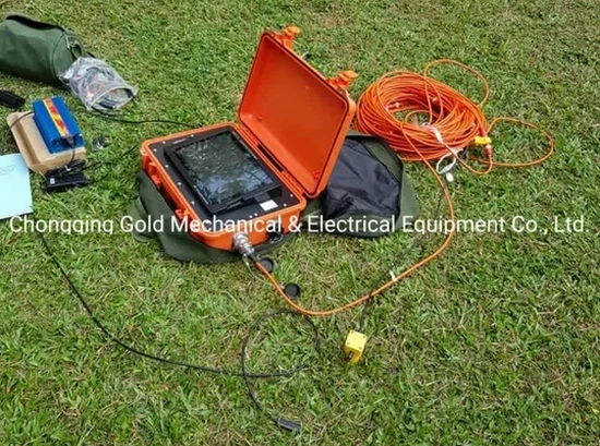
A seismic velocity tomogram shows the weathered-rock transition in gradational detail that no drilling program, no matter how dense, can physically capture.

Our service areas

How we work

In the Midlands, we deal with a profile that goes from residual Piedmont soil into partially weathered gneiss and schist — and the transition is never uniform. Refraction tomography maps that interface because the compressional-wave velocity jumps from around 1,500 ft/s in residual soil to over 8,000 ft/s in competent rock. We run 24- or 48-channel spreads with a sledgehammer or accelerated weight-drop source, depending on target depth. The tomographic inversion processes first-arrival traveltimes iteratively — the result is not a layered model with sharp boundaries, but a smooth velocity gradient that shows you exactly where the diggability changes. For deeper targets like karst features in the underlying carbonate units east of town, reflection surveying images impedance contrasts below 100 feet where refraction loses resolution. The data goes straight into the slope stability analysis when a cut face exposes dipping rock, or into deep excavation design when the water table inside the saprolite complicates a basement dig.
Seismic Tomography Surveys in Columbia, SC — Refraction & Reflection for Site Characterization
Technical reference — Columbia South Carolina

Local considerations

Columbia has grown outward from the Congaree bluffs into terrain that alternates between river terrace deposits and deeply weathered crystalline basement. The old mill villages along the Saluda and Broad Rivers were built on whatever ground was flat enough — and a lot of that ground sits on variable fill over alluvium, with bedrock depth changing by 30 feet across a single lot. When a contractor assumes uniform rock at a shallow depth based on a couple of probe points, the excavator hits hard granite where the budget expected soil, or worse, sinks into a soft zone where a footing was designed for rock bearing. Seismic tomography reduces that uncertainty to a manageable level. The velocity cross-section tells the structural engineer where to expect differential settlement and gives the earthwork estimator a realistic picture of rippability before the first machine shows up on site.

Need a geotechnical assessment?

Reply within 24h.

Email: contact@geotechnical-engineering.vip

Explanatory video

Applicable standards

ASTM D5777-18 Standard Guide for Using the Seismic Refraction Method, ASTM D7128-18 Standard Guide for Surface-Wave Methods (when integrated for Vs), IBC 2021 / ASCE 7-22 Chapter 20 Site Classification Procedure

Typical values

ParameterTypical value
MethodSeismic refraction tomography (SRT) and seismic reflection profiling
Source typeSledgehammer, accelerated weight drop, or Betsy seisgun for shallow targets
Typical spread24 to 48 geophones at 5 to 10 ft spacing, depending on resolution required
Depth of investigationRefraction: 15% to 20% of spread length; Reflection: >100 ft with appropriate source energy
Primary output2D P-wave velocity tomograms, depth-to-bedrock contours, rippability maps
Applicable standardASTM D5777-18 for seismic refraction; ASTM D7128-18 for surface-wave methods if combined
Site class outputVs profiles for IBC/ASCE 7 site classification when integrated with MASW or downhole data

Common questions

What is the typical cost for a seismic refraction survey on a single-family lot in Columbia?
How deep can seismic refraction see in the Piedmont saprolite around Columbia?

Depth of investigation is controlled by the spread length — typically 15 to 20 percent of the total geophone array length. A 240-foot spread with 10-foot geophone spacing reliably images to about 35 to 50 feet in residual soil and weathered rock. If the target is deeper, we extend the spread or switch to a reflection configuration. The velocity contrast between saprolite and competent gneiss in the Midlands is usually strong enough to produce a clear first-arrival break.

Do you combine seismic tomography with intrusive borings on the same project?

Yes, and we recommend it. The tomography provides continuous lateral coverage between boreholes, and the borehole logs calibrate the velocity model — a known rock type at a known depth turns a velocity contour into a lithologic boundary. On most commercial sites in the Columbia area, we run one or two SPT borings in parallel with the seismic lines so the geotechnical model is anchored to physical samples and standard penetration data.

Location and service area

We serve projects across Columbia South Carolina and surrounding areas.

View larger map